Tuesday, April 13, 2010

Two Weeks of Mischef and Mayhem

WOW!  Once again I have had incredible adventures over the past two weeks.  I'm going to try to make this post heavy on the pictures so you don't get sick of my narration (and adjectives) but still get the idea of how fantastic it was!

With my field trip to the south and my Easter Break travels in the middle I've traveled pretty extensively.  Here is a map to give you a sense of what I've been up to.  The black dot in Fiordland is Borland and the thick red line with the black dots shows my Easter Break route.

 My first adventure was with my New Zealand Field Studies and Mapping class to Borland.  Just like with our last field trip our task was to map the contacts and outcrops we saw, but this time we had the added complication of seeing all three rock types (igneous, metamorphic and sedimentary) and some crazy structural features (faults, anticlines and synclines.)

Fortunately, this field trip involved much more comfortable conditions than our previous field trip to Maerewhenua.  This time around we were housed in small cabins and had pretty good food every night and even some local beer on the last night!  We also got very lucky with the weather.  Fiordland is known for being extremely rainy during this time of the year (for evidence please read my last post!) but we were fortunate enough to have only one day of rain.  The good weather meant that we had fantastic views from the top of the Borland Mountain Saddle, a beautiful lunch stop on the first day and a gorgeous sunrise on the second day.

 (People going clockwise: Christine-UVM, MacKenzie-Smith, me-Mac, Louis-Mac, Tim-Colby, Travis-Hamilton, Cassidy-Hamilton and Drew-Hamilton took the picture.)

At the end of the lunch stop pictured at right a rather amusing event occurred.  As we were attempting to pull back on to the gravel road a large boulder got rolled under the axle of our van.  After much rocking (haha) of the van we realized that we could not shake the vehicle loose and were going to have to lift it up so that someone could crawl under the van and knock the rock out of the way.  So everyone got into position around the back of the van and lifted it up.  Then, one brave instructor crawled under the van and removed the offending cobble. 
We saw some pretty cool rocks too, my favorites were the turbidites which are packages of sediments representing the sequential failure of submarine slopes.

However, on the last day of the field trip our luck ran out and it began to pour.  This made our visiting the last outcrops somewhat difficult, especially since part of the day involved mapping along a riverbank.  We started off tramping along the river and were forced to make a river crossing where the water was up to our calves.  On the way back at the end of the day it reached mid thigh.  Notice I didn't say it began to rain....it really was pouring!

After our eventful week in Borland we returned to Dunedin for a day to dry out and rest up.  For me resting up involved sorting through a lot of e-mails including two of particular interest.  The first was from Columbia University notifying me that I had been offered an internship at their Lamont Doherty Earth Observatory this summer!  This is incredibly exciting because it means that I get to work with Dr. Jerry McManus on constraining the relative timing of glaciations in North and South America.  It is also exciting because it means that I will be spending ten weeks living on New York City's Upper West Side.  Visitors welcome!!

The second piece of e-mail awaiting me contained news of my being awarded the Barry M. Goldwater Scholarship!  Needless to say these were both fantastic lead-ins to Easter Break.

So after a day of rest (it was good Friday after all) Christine and I headed off on a bus to the resort town of Wanaka.  In Wanaka we spent a few minutes getting organized and then we started off on our first real adventure: HITCHHIKING!!  We had been told that New Zealand is one of the best places in the world to hitchhike and since the bus tickets were so expensive, despite the fact that our stop (Makarora) was only an hour and a half up the road, we decided to go for it!

After waiting about 15 minutes we were picked up by Ben, Emma and their dog Kiera (who we got to pet!) who took us about a half hour up the road to their turnoff.  We then waited about five minutes and were picked up by Graham, a Department of Conservation District Manager.  When Graham found out that we were headed to Makaroa to hike the Wilkins-Young Circuit he began to tell us about the geological and settlement history of the area.  He was an excellent tour guide and clearly eager to talk about the area.  As we neared Makarora it began to rain and since Christine and I had been planning on camping out that night we gratefully accepted Graham's offer of rooms in his DOC house overnight.  Now before you get all creeped out, it was really very nice!  We each had our own rooms and watched a documentary about chimpanzees before going to bed early.

The next morning (clear skies) we were set to begin our hike with a river crossing, but since it had been raining it was impossible to cross the river.  Instead, Graham dropped us off (on his way to an Easter Sunday Service) at the Blue Pools trail head which added an extra 7 km to our hike but got us on our way.

That day we did 27.5 km to reach Young Hut where we were very lucky to arrive early enough to get one of the 20 bunks.  That night about 20 more people slept on the floor and outside!  A popular track indeed.

The next morning we set off for the pass crossing which involved 1000m ascent (which led us to the snow line) and 861m descent over the course of 11.5 km (see picture for an idea of the incline).  Needless to say we were pretty exhausted when we finally reached Siberia Hut late that afternoon.  However, it was well worth it!
 (Top: Mount Awful (stolen from the DOC website) Bottom: Mt. Dreadful)

On our final day we again had beautiful weather (it actually never rained during the whole trip except for that first night) and hiked 29 km back to Makarora and across the Makarora River which was no longer at flood stage but was still up to our butts and flowing very quickly (the picture is taken significantly upstream at a lake).  For those of you keeping track that's a total of 42 miles and 4,888 feet of vertical in three days.

The next day we were picked up in Makarora by Louis and his dad who was visiting over the break. Together the four of us drove through Haast Pass and up the West Coast to Fox Glacier where we spent the afternoon on a "1/2 day glacier adventure."
The next day we drove to the town of Greymouth where Christine and I said goodbye to Louis and his Dad and jumped on the TranzAlpine Train which took us through Arthur's Pass, across the mountains and down into Christchurch on the East Coast.  This was a stunning journey but it also made me realize how difficult it is to take pictures from a moving train which is why I'm not including any pictures.


The day after we arrived in CHC, we took a bus to Banks Peninsula and the French town of Akaroa.  In Akaroa we checked in to a delightful backpackers hostel and then headed out to do some sea kayaking.  We had beautiful views of the volcanic crater that forms Banks Peninsula and also got to kayak along with four dolphins!


The following day we hiked to the rim of the Caldera (another 590m or 1,935 feet for those of you keeping track) and saw beautiful views of the peninsula and the ocean.

Finally, on Saturday we returned to Christchurch where we stayed the night with a friend of Christine's who is studying abroad at the University of Canterbury.  Sunday morning we visited my old school (Ilam), which looked exactly the same as it did 14 years ago.  That afternoon after meeting up with Louis and his dad again (who took us out to lunch at a phenomenal place called Burgers & Beers Inc.) we all drove back to Dunedin!

And that is the short version of what I've been up to over the past two weeks!

I think it's probably time for me to get back to the studying part of my study abroad experience!  This weekend is going to be a quiet one, but plans are being set for trips to the Catlins and Mt. Cook!  Stay tuned....

Love,
Allison


Wednesday, March 24, 2010

Wild and Wet Weekends

Well, I've been remiss again and let two weekends pass without writing of my adventures.  However, that means that this entry is going to be twice as exciting (as if you hadn't guessed already from the title) so brace yourselves...!

Every year, on the second Saturday in March, the Wild Foods Festival takes place in Hokitika on the west coast of the South Island.  The festival was first instigated by a local woman whose cellar was overflowing with rose petal wine.  To reduce her stocks and create a general atmosphere of ...merriment... amongst her fellow townspeople she decided to share and soon other locals joined in bringing along an assortment of wild oddities.  Today the original concept has been rather distorted (for the better I'm sure) and it's now the place to go to sample a variety of very very strange 'delicacies.'

Not wanting us miss out on this west coast tradition, Louis and Christine's Kiwi Host, Aleisha, generously offered to drive us to Hokitika to participate in the ...merriment... with the rest of her flat and a group of her friends.  But before we arrived at the festival we had a fantastic drive up the east coast of New Zealand and across the mountains through Arthur's Pass.  Fortunately, because we weren't pressed for time (no one ever is in this country) we got to stop at a number of exciting places along the way.

The first of these stops was at the Moeraki Boulders, just north of Dunedin. The Moeraki Boulders are big grey concretions which have been eroded from cliffs behind them.  Geologists think that they were created when hot, calcite-rich waters permeated the cliffs and cemented the mudstones together.  The Māori believe that the boulders are the remnants of eel baskets and kumara (like a sweet-potato, except from heaven) that washed ashore after the canoe of an atua (ancestor) was wrecked.  This brings up the fact that I've been learning a lot of interesting Māori creation narratives in class which I'll introduce as relevant to my adventures.  Anyways, most tourists, myself included, just think that the boulders make for a pretty good photo op.

After Moeraki, we made a quick stop to see if we could spot any penguins in Omaru.  We only saw these three and they were quite funny looking so we didn't stop for long....

 After waiting for the car carrying Aleisha's friends to catch up with us at her parent's house in Timaru, we started off inland to cross Arthur's Pass.  The greater part of this drive was in the dark but we did get to see it in the daylight on the way back.  The views were pretty great even though it was a little misty and it made me realize how much I was dying to go tramping again!

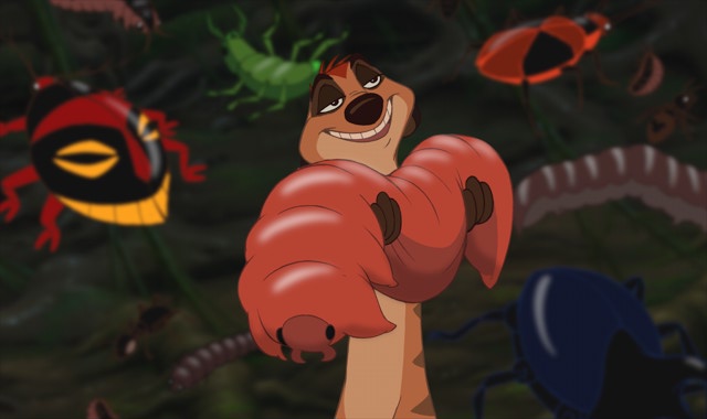
Eventually (after a stop for the night in Gremouth at another friend's house) we finally arrived at the Wild Foods Festival.  It was pretty crazy, with lots of people dressed up in costumes and in various states of inebriation.  Once we got into the festival we stopped just inside the entrance at the Huhu grub stand because Louis entertainingly/stupidly had promised to eat the first thing he saw.  A Huhu grub is much like those morsels Timon and Pumba ate in the Lion King and apparently tastes just the same...like chicken.
From there we roamed all over the grounds sampling snails (escargot to you!), sandflies in jelly (revenge was sweet), wild green-lip mussels (my favorite), wild pork (oink oink) and the specialty of the Wild Foods Festival: Mountain Oysters aka. Sheep balls.  Greasy but not bad.... We capped the whole day off with a starry night on the beach next to a roaring bonfire.

But wait!  That's only the Wild part of the blog...!

 Last weekend I decided (based on our beautiful trip though Arthur's Pass) that it was time for some more tramping.  Fortunatley, the Otago University Tramping Club (OUTC) does a huge trip (many groups) every year to Fiordland.  So last Friday night I set off for what turned out to be the most stupid and dangerous thing I have ever done in my life.

The plan was to approach the Routeburn Track from the west, take it to it's junction with the Caples Track, follow that to the top of the Alisa Mountains (photo stolen from the internet-we never saw further than 100 m in front of us) and then follow the 1500 m contour of the Alisa Mountains (above treeline and just below snowline) until we found a suitable place to drop down below treeline and camp.  The second day we were to continue along the contour until we found a bit of a break in the brush, scramble down 40 m through dense rainforest and find ourselves  back on the Routeburn Track.  If that made very little sense, I'm not surprised, please check out the blue line on the map.


In reality this is what happened (and here I am momentarily suspending my pledge not to complain): we arrived at the trail head at 11pm Friday night and spent the night in a picnic/bus shelter while it poured.  Saturday we awoke and started off through a light rain.  We knew we were going to get wet but we didn't have a clue just how wet.

By the time we reached the saddle of the Alisa Mountains on the Caples Track at lunchtime it was pouring and the wind was blowing like mad (we found out later it reached gusts of 60 miles/hour.  But because we were still warm and we knew where we were, we started off again, this time following the contour line on our map.
 
The going was pretty rough, the top of the mountain was really a bog and our feet sank into the mud with every step we took.  It wasn't long before our 'waterproof boots' and expensive 'rain jackets' were nothing more than dead weight trapping water to our skin.  As we walked the clouds had descended and pretty soon we realized that we could no longer find our place on the map because we couldn't see from the front of our group (6 people) to the back let alone to the nearest landmark to take a bearing.  In other words we were totally lost, in a rainstorm, with gusts of winds that would knock you over if you didn't keep walking.  We contemplated turning back but didn't think we could reach the valley floor before nightfall.

Eventually it started to get dark and we decided that we needed to drop below treeline to make camp for the night.  I think it was at this point that I realized just how much trouble we were in.  Soaked to the bone we were going to camp under a flimsy tent fly with our sleeping bags on the sodden ground. 

That night we stayed warm by lying tightly packed together.  This wasn't one of those cute cuddling moments, it was a huddle or hypothermia, spoon or suffer the consequences moment. 

All though the night and the next morning the rain continued.  When we got out from underneath the fly I didn't even bother putting on my rain jacket.  After another few hours struggling against the wind and rain we realized that we weren't going to find the easy way down through the trees and just plunged down through them.  When we emerged sodden, scratched, muddy and exhausted at the bottom of the valley and finally found the Routeburn Track we were elated and much high-fiving and consumption of emergency chocolate ensued.

Just in case you think I'm exaggerating as I write this blog (4 days later) little facts like this these keep popping up.
  • More than 100 trampers have been evacuated from mountain huts in Fiordland
  • The Milford and Routeburn tracks have been closed until the debris-strewn Milford highway is cleared.
  • 20 walkers were yesterday flown out from the Howden Hut on the Routeburn Track.
  • A tree fell on the rangers' quarters at the Mackenzie Hut on the Routeburn, and a large window was blown out at the Luxmore Hut on the Kepler Track (I stayed there last month).
  • "I come from Florida and I've been through hurricanes before, and I can say that some of the winds that came through here were like a category two storm"
  • Flooding had "eaten away" the highway in places.
And that, my friends, was the Wet weekend!

More in two weeks after my final Field Studies field trip and Spring Break spent hiking the Wilkins-Young Circut (got to get back on that horse) and touring Fox and Franz Josef glaciers.

Glad to be alive,
Allison

Wednesday, March 10, 2010

Long Time No Blog

I must apologize, for it has been almost a month since my last post!  I have nothing to say for myself except that I have been busy having fun (which I feel is a valid excuse).

At the close of my last entry I mentioned that I was moving to a new flat.  I am now settled comfortably at 19 Montgomery Ave. in a much larger and brighter room, with a lovely, functional kitchen and airy common room.

My new roommates are named Julia and Katie and are both infinitely better than the girl I was previously stuck with: Ashlyn.  For comic relief here are several interesting points about Ashlyn...
  • A cheerleader from Arkansas with the obligatory fake tan and bleached hair
  • The proud owner of two books: the bible and a travel guide to New Zealand
  • Wore hot pink, rhinestone-studded, velour Juicy Couture track sets
In favorable contrast: Julia is a graduate student from Germany who is studying chemistry and Katie is a fellow liberal-arts undergrad who goes to Bates College in Maine.

A few days after I moved it was time for 'course approval.'  This basically means going around to each of your professors and getting them to sign a piece of paper saying that you can enroll in that 'paper.'
(Picture is looking out of the Geology Department towards the Clocktower) 

This was a boring exercise, but I was fortunate to have good company.  Louis and his flatmate Christine,  joined me and together we navigated through both the rain and the campus, successfully obtaining signatures and eventually ending up with our student ID's.  Christine (picture) is from Pennsylvania but goes to the University of Vermont at Burlington where she majors in environmental science and has a concentration in geology.  As you can probably tell from the second half of that sentence: we get along really well and have been hanging out quite a bit (we also have two classes together).  In fact, this weekend we are headed to the Hokitika Wild Foods Festival (more on that later) and are hopeful that over Fall Break we can go tramping together on the North Island.

The day after course approval, Louis, Christine and I hiked to the top of Mt. Cargill (the second time for me) and the following day we did the Pineapple Track.  Since the Pineapple Track didn't look very far away on the map we decided to walk to the trail head, rather than take the bus.  Unfortunately, our map was not really designed to be used anywhere other than right on campus and the mapmakers seem to have magnified the university at the expense of accurately portraying off-campus distances.  Consequently, what looked like only a few short blocks on the map turned out to be a 5km hike just to get to the trail head (one way).  This would have been fine except for the fact that we got lost on the way and the hike itself was not exactly a flat 5k.  Fortunately, it was worth it: the view from the top gave us an excellent sense of Dunedin's geography.  15k? No worries mate!

However, classes had to start sooner or later (it's already mid semester at Mac!) and for us they began a little earlier than for everyone else.  The week before school officially started (March 1st), Christine, Louis and I took a field trip for our "Field Studies and New Zealand Geology" class.

On Tuesday we set off for Maerewhenua (near Oamaru-since you all know where that is) where we were to spend four days mapping the regional geology.  Each morning we awoke around 7am, made sandwiches for ourselves (peanut butter and jelly for Christine and myself, Marmite and margarine for Louis) and spent until 7pm in the field mapping outcrops and unit contacts.  Every evening we would have dinner (uughhh) and then spend from 8:30 until 11:30 drawing our maps.  

If that sounds like a lot of work, that's because it was!  Unlike geology trips at Macalester which typically involve copious amounts of alcohol and lots of dangerous antics with rock hammers (you didn't read that Mum) this trip was lame!  We may have been divided up into several FIELD PARTIES! but there was no FIELD PARTYING! and certainly no Maerewhenua (haha)!  Not only was the evening entertainment lacking, but because we had trouble finding Christine's bag we ended up sleepng in a Vietnam-era tent (instead of a cabin) which was very cold at night, very hot during the day and made me feel like Allen Alda was about to burst through the flap at any moment.  

The end goal of the project was to write a 3,000 word essay explaining the geology of the area, make a geologic map of the area, draw two cross sections through the region and create two stratigraphic columns showing unit thicknesses and major features.  We have no idea how it's going to be graded but you know: 
Don't even worry about it, it is what it is...
If you are having trouble falling asleep, you may be interested in reading my abstract (at the bottom).  

So classes started in earnest last week and while it's still too early to tell which ones are going to be good I'll give you a quick rundown.

1) Field studies and NZ geology-80 kids-Lacks direction
2) Maori Culture Studies-260 kids-The head lecturer is prone to tipping over mid-sentence, this is very entertaining and I like her a lot
3) Paleoceanography-This is a graduate class which is actually a course and a third (24 points instead of 18) and is comprised of one 'module' entitled Paleoceanography (me and one other kid) and one 'module' entitled Isotope Geochemistry (8 people).

Well, that should catch us up!  This weekend we're off to Hokitika to see the New Zealand Wild Foods Festival.  We're driving past the Moeraki Boulders, through Arthur's Pass, Christine is curious about trying some grubs, Louis has promised to eat sheep balls and I'm turning 21 so you know the pictures are going to be great....
Love,
A


Wednesday, February 17, 2010

From Christchurch, Claire and Canterbury to Sun, Surf & Sand

What a whirlwind week it has been!  As I mentioned last post, my friend Claire from Northfield came to visit me for a few days on her way to Australia and we were busy seeing the sights of Dunedin and Christchurch.

We began our week in the Botanic Gardens exploring some of the further reaches I hadn't yet seen.  The extent of the garden is pretty impressive, there are numerous individual gardens dedicated to particular species of plants and specific regions around the world.  We visited the aviary, a garden of South African plants, a valley of ferns and some truly magnificent trees.  Claire was especially impressed by the gardens, having taken plant morphology at St. Olaf she was well equipped to appreciate the genetic relationships and kept telling me about similar plants in the U.S..


The next day we took a bus to the foot of Mt. Cargill (named after one of the founders of Dunedin) and climbed it for panoramic views of the city.  It was a little overcast but it was still beautiful and allowed us to get an excellent sense of our place in the city and surrounding harbors.  My favorite part of this hike was that it took us past the Organ Pipes-an outcrop of columnar basalts formed when the peninsula was still volcanically active.


The next day we visited the Cadbury factory with Jeff, a friend from Macalester (who also accompanied us to Mt. Cargill).  This was a truly unique experience as it is the only Cadbury factory in the whole world that gives tours.  During the tour we picked up lots of chocolate but unfortunately no pictures.  Photography is not allowed in the factory (think Willy Wonka's secrecy) so we had to satisfy ourselves with photos in front of the Cadbury delivery trucks.  Afterwards, we hit up the factory shop where we made a number of delicious purchases including a bar of dark chocolate with coffee, Irish cream, orange and hazelnut fillings in each square.  Heaven!
  
Next up on the schedule was a trip to Christchurch where we stayed for three nights and two days.  The first day we spent our time checking out the city itself.  Our first stop was Cathedral Square, home of the famous Christchurch Cathedral.  The front of the cathedral itself was undergoing repairs so I'll substitute this internet photo for one of my own.  We also encountered a small flea market here but it was nothing compared to the arts fair we saw next on the grounds of the old university.  Christchurch is home to Canterbury University where chemist Ernest Rutherford used his gold foil experiment to demonstrate the existence of an atomic nucleus.  His old laboratories now are now the workshops of fine craftsmen, including a group of spinners and knitters who make beautiful hats, sweaters and scarves out of wool from New Zealand's many sheep.  
Right next to the old University are the Christchurch Botanical Gardens, I'll let the pictures speak for themselves.


Next, we rented kayaks and went boating on the Avon river.  This was an interesting experience because our visit coincided with the kayaking leg of the Speights Coast to Coast, a triathalon of running, biking and paddling from the East to West coast of New Zealand.

As if all that wasn't enough, we also visited the Christchurch Museum of Art.


 On our second day in Christchurch we rode the gondola hoping to catch views of the harbor and out towards the Southern Alps.  Unfortunatley, it was rather cloudy, but the time we spent waiting for it to clear wasn't wasted.  Many a hand of gin was played!


For Claire's last day we decided to get a group together and go to Tunnel Beach.  Claire, Peggy (another Mac student), Louis, Jeff and myself all piled onto the bus and spent a beautiful afternoon on a beach accessible only by a tunnel through the rock.  The tunnel was constructed by Mr. Cargill (the founding father) so that his daughter could have a private beach to herself, away from the riff raff of Dunedin.  Supposedly she drowned on her first visit.  Fortunately, We avoided all mishaps (the water was too damn cold) and simply enjoyed the scenery. 

Well, my last bit of news is that next time I write I will be including pictures of my NEW flat!  That's right, I'm moving one street over tomorrow for a bigger room, a quieter street and a much much nicer kitchen.  Can't wait!

Miss you all,
Allison

Monday, February 8, 2010

Abel Tasman National Park

This Sunday I returned from a week spent hiking the Abel Tasman Track at the northernmost tip of the South Island.  The map shows the route we hiked from Marahau in the South to Wainui Bay in the North. 


To get to the Abel Tasman we traversed the better part of New Zealand's East Coast by bus.  Between the two of us we had a total of 14 bus tickets and I'm pleased to report that we didn't miss a single one (although a water bottle and a book were left somewhere in there)!  While riding that many buses was rather exhausting, driving was an excellent way to see the landscape of New Zealand.  Because there aren't any interstates here (it was two-lane roads the whole way) you really experience relatively unadulterated scenery as you drive along.  From the idyllic pastures of the farms around Dunedin, to the rugged coastlines and seal colonies of Kaikoura to vineyards and orchards of the Marlborough district it was all beautiful.  The only downside was that many of the roads involve a tremendous number of switchbacks leaving me feeling rather queasy.

The first night on the road we spent an unremarkable night at a hostel in Christchurch but the following night we camped in the small seaside town of Marahau where we saw people riding horses in the surf as the sun went down.  Marahau is where most of the water taxis and kayaking outfitters who take tourists along the Abel Tasman Track are headquartered.  Both of these modes of transport are very popular allowing people of all levels of fitness (but only high affluence $$$) to access the track.  While I was very happy to walk, I think kayaking would also have been fantastic, it was so hot (around 80 F) and the water always looked tempting! 

The track itself was everything we were promised: each day we swam in turquoise waters, ate dinner on beautiful sandy beaches and saw the stars of the Southern sky at night, all in perfect weather.  Unfortunately the sandflies were also as promised.  Despite the application of 95% deet and a strange roll-on sort of bug-spray Louis picked up we both got bitten up terribly and will be reaching for the anti-itch cream for some time.

One of the more unique elements of the Abel Tasman was that it involved tidal crossings which could only be accomplished within a few hours of low tide.  This meant that on several occasions we had to get up quite early in the morning (allowing me to take this picture of a spectacular sunrise), but it also ensuring that we had plenty of time in the afternoons for swimming and reading.


I have to admit some disappointment at not meeting any more really interesting people on the trail.  There were a few groups that seemed promising (including a large group of college students from Winona State University in MN) but the most significant conversation we had was with a group of older trampers from the US (Louis heard them call us nice kids.) 

Our last few hours on the trail were spent discussing all the food we wanted to eat once we got back to civilization (the hot dogs of Chicago and the bratwurst's of Louie's Finer Meats were both explicated in detail).  A number of different options were discussed but ultimately we ended up eating Italian (with some local wine) and topping it off with ice cream.  While I went for the homemade Maple Walnut, I suggested that Louis go for the "Hokey Pokey" flavor.  Having "experienced" this uniquely New Zealand flavor on my previous visit (it was awful) I suspected that its totally artificial sponge toffee taste would appeal to him.  It did, and he is now hooked on the stuff.

Our way back we spent another night in Christchurch and I dragged us out to see the Royal Botanic Gardens at night.  We couldn't see much in the dark, but I'm hopeful that when Claire (a friend from Nfld.) and I visit again next week we will see them as I remember them.

On that note: Claire is coming to visit me tomorrow!  I have a number (read: a ton) of rather exciting activities planned including a picnic in the Dunedin Botanic Gardens, a hike up Mt. Cargill for views of Dunedin and some exciting columnar basalts, a tour of Cadbury World, a walk up the World's Steepest Street, a day touring in Christchurch, a trip to Banks Peninsula to bicycle the caldera, a trip to St. Clair Beach in Dunedin, a day trip to see Larnach Castle and the Yellow-Eyed Penguin Colony and a day hike to Tunnel Beach. Whew!!!!  The next post is going to be full of crazy excitement.

Can't wait!
Allison