 Every year, on the second Saturday in March, the Wild Foods Festival takes place in Hokitika on the west coast of the South Island. The festival was first instigated by a local woman whose cellar was overflowing with rose petal wine. To reduce her stocks and create a general atmosphere of ...merriment... amongst her fellow townspeople she decided to share and soon other locals joined in bringing along an assortment of wild oddities. Today the original concept has been rather distorted (for the better I'm sure) and it's now the place to go to sample a variety of very very strange 'delicacies.'
Not wanting us miss out on this west coast tradition, Louis and Christine's Kiwi Host, Aleisha, generously offered to drive us to Hokitika to participate in the ...merriment... with the rest of her flat and a group of her friends. But before we arrived at the festival we had a fantastic drive up the east coast of New Zealand and across the mountains through Arthur's Pass. Fortunately, because we weren't pressed for time (no one ever is in this country) we got to stop at a number of exciting places along the way.

 After Moeraki, we made a quick stop to see if we could spot any penguins in Omaru. We only saw these three and they were quite funny looking so we didn't stop for long....
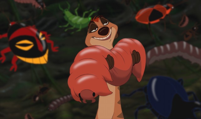 Eventually (after a stop for the night in Gremouth at another friend's house) we finally arrived at the Wild Foods Festival. It was pretty crazy, with lots of people dressed up in costumes and in various states of inebriation. Once we got into the festival we stopped just inside the entrance at the Huhu grub stand because Louis entertainingly/stupidly had promised to eat the first thing he saw. A Huhu grub is much like those morsels Timon and Pumba ate in the Lion King and apparently tastes just the same...like chicken.
 From there we roamed all over the grounds sampling snails (escargot to you!), sandflies in jelly (revenge was sweet), wild green-lip mussels (my favorite), wild pork (oink oink) and the specialty of the Wild Foods Festival: Mountain Oysters aka. Sheep balls. Greasy but not bad.... We capped the whole day off with a starry night on the beach next to a roaring bonfire.
But wait! That's only the Wild part of the blog...!
Last weekend I decided (based on our beautiful trip though Arthur's Pass) that it was time for some more tramping. Fortunatley, the Otago University Tramping Club (OUTC) does a huge trip (many groups) every year to Fiordland. So last Friday night I set off for what turned out to be the most stupid and dangerous thing I have ever done in my life.
The plan was to approach the Routeburn Track from the west, take it to it's junction with the Caples Track, follow that to the top of the Alisa Mountains (photo stolen from the internet-we never saw further than 100 m in front of us) and then follow the 1500 m contour of the Alisa Mountains (above treeline and just below snowline) until we found a suitable place to drop down below treeline and camp. The second day we were to continue along the contour until we found a bit of a break in the brush, scramble down 40 m through dense rainforest and find ourselves back on the Routeburn Track. If that made very little sense, I'm not surprised, please check out the blue line on the map.


By the time we reached the saddle of the Alisa Mountains on the Caples Track at lunchtime it was pouring and the wind was blowing like mad (we found out later it reached gusts of 60 miles/hour. But because we were still warm and we knew where we were, we started off again, this time following the contour line on our map.
The going was pretty rough, the top of the mountain was really a bog and our feet sank into the mud with every step we took. It wasn't long before our 'waterproof boots' and expensive 'rain jackets' were nothing more than dead weight trapping water to our skin.
 As we walked the clouds had descended and pretty soon we realized that we could no longer find our place on the map because we couldn't see from the front of our group (6 people) to the back let alone to the nearest landmark to take a bearing. In other words we were totally lost, in a rainstorm, with gusts of winds that would knock you over if you didn't keep walking. We contemplated turning back but didn't think we could reach the valley floor before nightfall.
 Eventually it started to get dark and we decided that we needed to drop below treeline to make camp for the night. I think it was at this point that I realized just how much trouble we were in. Soaked to the bone we were going to camp under a flimsy tent fly with our sleeping bags on the sodden ground.

All though the night and the next morning the rain continued. When we got out from underneath the fly I didn't even bother putting on my rain jacket. After another few hours struggling against the wind and rain we realized that we weren't going to find the easy way down through the trees and just plunged down through them. When we emerged sodden, scratched, muddy and exhausted at the bottom of the valley and finally found the Routeburn Track we were elated and much high-fiving and consumption of emergency chocolate ensued.
Just in case you think I'm exaggerating as I write this blog (4 days later) little facts like this these keep popping up.
- More than 100 trampers have been evacuated from mountain huts in Fiordland
- The Milford and Routeburn tracks have been closed until the debris-strewn Milford highway is cleared.
- 20 walkers were yesterday flown out from the Howden Hut on the Routeburn Track.
- A tree fell on the rangers' quarters at the Mackenzie Hut on the Routeburn, and a large window was blown out at the Luxmore Hut on the Kepler Track (I stayed there last month).
- "I come from Florida and I've been through hurricanes before, and I can say that some of the winds that came through here were like a category two storm"
- Flooding had "eaten away" the highway in places.
And that, my friends, was the Wet weekend!
More in two weeks after my final Field Studies field trip and Spring Break spent hiking the Wilkins-Young Circut (got to get back on that horse) and touring Fox and Franz Josef glaciers.
Glad to be alive,
Allison


